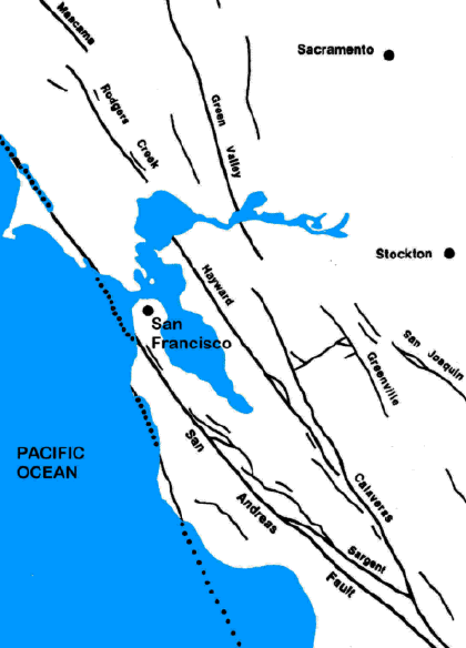
| The geology of San Francisco Bay is
dominated by the San Andreas Fault System. This system of faults
forms the boundary between two major crustal plates: the Pacific plate
and the North American plate. The relative northwestward movement
of the Pacific plate relative to the North American plate produces
seismic activity within the zone. Seismic activity is primarily
associated with several major active faults within the system including
the San Andreas, Hayward, and Calaveras faults along with other shorter
fault segments.
The Central Park area is underlain by sediments that have been deposited by Alameda Creek, on its way to emptying into San Francisco Bay. These sediments, referred to as the Niles cone, consist of sand, gravel, silt, and clay, with the finer materials interpreted as floodplain deposits. Exploration borings and trenches have revealed that the sediments in the Central Park area are primarily fine-grained with a few gravel lenses. Bedrock is expected to be at least several hundred feet deep in the area. Two traces of the Hayward fault have been mapped through Central Park. the westerly trace is believed to be the active one, while the easterly trace has not been found south of the Civic Center. The Hayward fault acts as a groundwater barrier, causing subsurface water to build up on the east side of the fault. Stivers Lagoon, modified into Lake Elizabeth, is such an accumulation of groundwater that fills a depression, formed as a result of the fault and referred to as a "sag pond". Tule Pond at Tyson's Lagoon, north of Stevenson Boulevard and along the fault, is another similarly formed body of water that has also been modified. Recent soft sediments and marsh deposits have accumulated in the sag ponds. Together with the high ground water conditions caused by the barrier action of the fault, these soft ground conditions are susceptible to settlement, slope movement, and, during an earthquake, strong ground shaking and ground failure in the form of lateral spreading and localized liquefaction. |
 Lake
Elizabeth is located in an easterly portion of the Coast Ranges that is
bounded by the Great Valley on the east, and in the San Francisco Bay
area, by the Hayward fault on the west. Northeast-southwest
compression acting over the last several million years has produced
steep folds and faults within the area. Faults that have been
created include the active Hayward fault that passes through Central
Park and dominates its geologic setting, and the active Calaveras fault
some seven miles to the east.